Flying Up to Speed with Drone Tech
Trends and Technologies in Drone Surveying
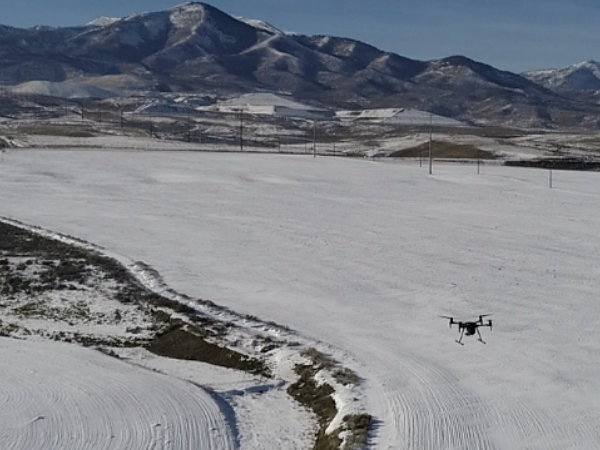
What is that UFO in the sky above the empty lot in the new development? Don’t call out the FBI just yet – chances are you’ve spotted a commercial drone working in tandem with a surveying team to get an accurate read of the land.
Focus Engineering & Surveying is approaching its second year with drone tech and is loving the ease and speed of use. “With drones, we can have everything designed and planned beforehand much faster than we did two years ago,” Spencer Llewelyn, Survey Department Manager, explains. “We need to have an accurate read of how the ground looks before any equipment starts pushing dirt around.” He mentions that the time needed to find problems with a specific site is drastically reduced, meaning time well spent for his department and Focus clients.
The current seven-person crew contains two members that are commercially licensed drone pilots. “Everyone on our team may not be a pilot,” Spencer confirms, “But all are skilled at analyzing different aspects of drone data.”
The proficiency in analyzing this specific surveying data is important because the technology surrounding drones and surveying keeps improving. One newer trend, aerial LiDAR (light detection and ranging) is a special combination of 3D scanning and laser scanning. Once implemented it will allow Focus to more accurately and efficiently filter out vegetation and other non-essential data while creating a highly accurate model, speeding up the entire process of surveying for clients.
But Spencer wants everyone thinking about drones to realize one thing: “This is not a cure-all for surveying needs,” he says. “But it is certainly a welcome tool in the arsenal, especially when we have awesome people to create the processes and operations of a survey department.”

Leave a comment
You must be logged in to post a comment.